


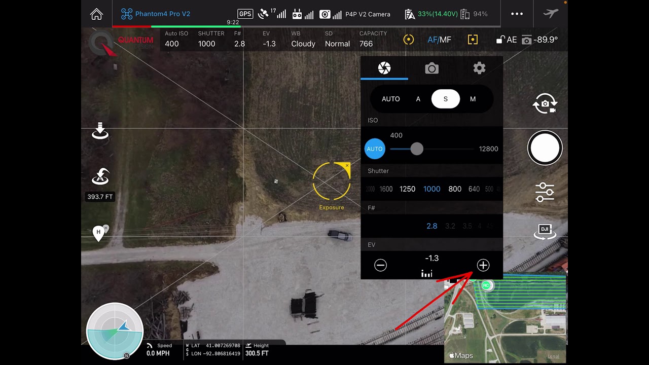
Low Light Camera Settings
Your Quantum Flight Pack is a great tool, but like any tool, you need to know the right way to use it. Getting the camera settings right...

Drone Topo GCP Location
Watch and learn the thought process that went into placing this Ground Control Point.


Drone Data Never Works Alone: Integrating Drone Surveys into Your Existing Workflow
Quantum Land Design was recently featured in Propeller Aero's Thought Leaders Blog series. The blog post expands on Zach's Tech Tal
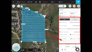
DJI Drone Camera Settings for Mapping and Survey
Quality pictures are required to get the best from your drone data. Here is a quick video showing you how to set up the camera on your DJI


Drone Surveying in Construction: Simple, Effective, and Cost-Efficient
Drones simplify construction surveying with just a GPS base/rover and a drone. Affordable, reliable data without the complexity.
Quantum Flight Pack - Flight Planning Video
Supplement your GPS machine control system with Quantum's Flight Pack drone system. In this video you will learn how to plan a topograp
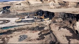
Integrating Machine Control with UAV Aerial Data Acquisition
Explore how UAV aerial data and 3D machine control are transforming heavy civil construction with Quantum Land Design & AeroView Services.


